Off the Beaten Map: Slot Canyons, Arches, and Geological Secrets Most Escalante Visitors Walk Right Past
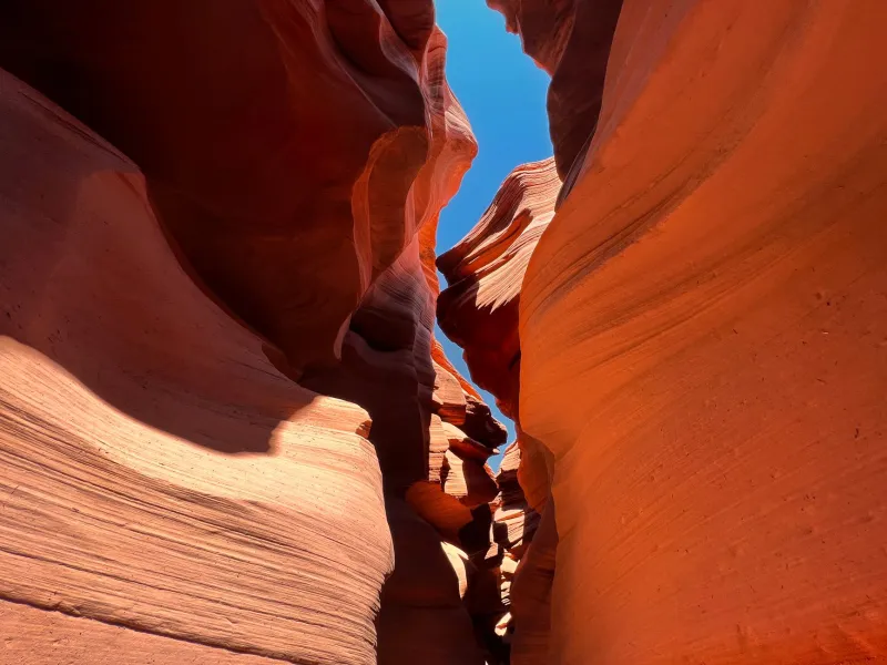
Most people who visit Grand Staircase-Escalante National Monument come home with photos of Zebra Canyon or Lower Calf Creek Falls. Those places are stunning — no argument there. But ask any seasoned desert rat about the spots that genuinely changed them, and you'll hear about a different Escalante entirely. A network of unmarked drainages, hidden arches tucked behind ridgelines, and pothole fields that look like something from another planet — none of it on a mainstream trail map, almost none of it in the glossy travel magazines.
Finding these places takes a little more effort. It also takes the right tools, a healthy respect for remote desert terrain, and honestly? A willingness to get a little lost on purpose. Here's how to start.
Why These Places Stay Hidden
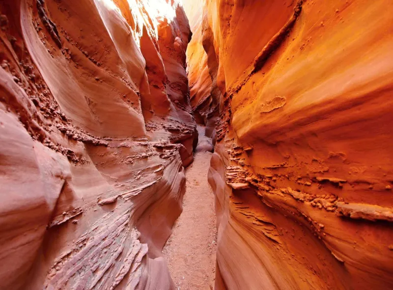
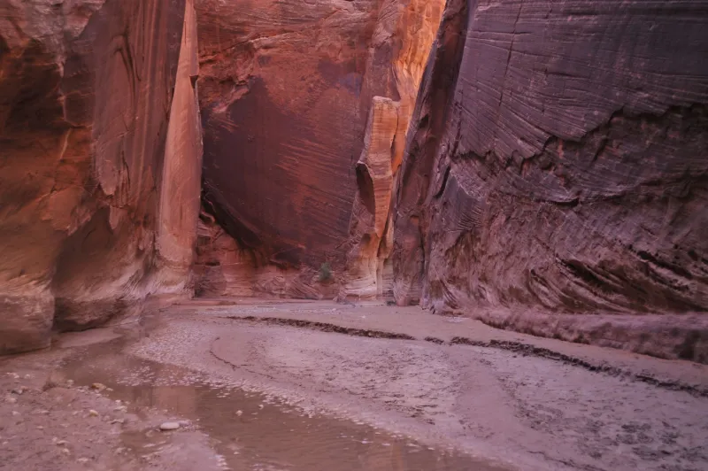
Escalante's geology is absurdly complex. The monument covers nearly 1.9 million acres of layered Navajo sandstone, Entrada formations, and ancient seabed deposits — a landscape so fractured and folded that even experienced hikers who've visited dozens of times keep stumbling onto features they've never seen before. Slot canyons form where water has carved through soft sandstone over millennia, often creating passages so narrow you have to turn sideways to squeeze through. Many of these drainages don't have official names. They don't appear on National Park Service trail maps. They exist because the land made them, not because anyone decided to build a trailhead nearby.
That's actually the point.
Your Most Important Tool: Topo Maps (and How to Actually Use Them)
If you're serious about finding Escalante's hidden landmarks, a standard trail map won't cut it. You need 7.5-minute USGS topographic maps, and you need to know how to read contour lines well enough to spot the telltale signatures of a slot canyon or arch before you're standing in front of one.
Slot canyons show up on topos as tight, closely-spaced contour lines running parallel to a drainage — the lines bunch together where canyon walls get steep and narrow. Look for drainages that drop elevation quickly over a short horizontal distance. Those rapid descent zones are where the water has done its most dramatic work.
Arches and natural bridges are trickier to spot on a map, but you can develop a feel for the right terrain. They tend to form on exposed fins and ridges where erosion attacks sandstone from multiple directions. On a topo, look for narrow, elongated high-ground features with steep drop-offs on both sides. Those fins are worth investigating.
Apps like Gaia GPS and CalTopo let you layer USGS topo data over satellite imagery, which is genuinely game-changing for pre-trip scouting. Zoom into drainages you're curious about, toggle between the satellite and topo views, and start building a mental picture of what you might find.
Pothole Gardens: The Desert's Hidden Ecosystems
One of Escalante's most underrated geological features barely registers on most visitors' radar — and it's literally underfoot. Potholes are bowl-shaped depressions worn into slickrock surfaces by centuries of water and sediment erosion. After rain, they fill with water and transform into temporary ecosystems: fairy shrimp, tadpoles, and aquatic invertebrates that have evolved to complete their entire life cycles before the water evaporates.
The best pothole fields in the Escalante region sit on broad sandstone benches away from established trails. To find them, look for large, flat expanses of exposed Navajo sandstone on your topo map — the kind of terrain that doesn't have much topographic relief but sits above a major drainage. These benches are often accessible by cross-country travel from canyon rims.
A word of serious caution here: never step in or camp near potholes. The cryptobiotic soil and aquatic life in these features are extraordinarily fragile. Step on slickrock only, observe from the edges, and leave zero trace.
Reading Local Knowledge the Right Way
Topo maps and satellite imagery will get you far, but nothing replaces local knowledge. The staff at Escalante Interagency Visitor Center are genuinely helpful — and importantly, they know which drainages are currently passable and which ones are dealing with flash flood risk or permit issues. Stop in before your trip, tell them what kind of terrain you're interested in, and actually listen to what they say.
Local outfitters and gear shops in the town of Escalante are another underutilized resource. People who've been guiding or recreating in this landscape for decades carry mental maps that no app can replicate. Buy something, ask genuine questions, and be receptive to the fact that some places are deliberately not advertised — and there are good reasons for that.
Online communities like the r/Escalante subreddit and various desert hiking forums can point you toward general areas worth exploring, though experienced desert travelers tend to be appropriately vague about exact coordinates for sensitive locations. That's not gatekeeping — it's stewardship.
Timing Your Search: Seasons Matter More Than You Think
The best time to explore off-trail terrain in Escalante is generally spring (late March through May) and fall (September through November). Summer brings brutal heat and an elevated risk of afternoon flash floods — a genuine life-threatening hazard in slot canyons, where walls can be hundreds of feet high with no escape route. Even a storm miles away can send a wall of water through a narrow canyon with almost no warning.
Spring offers something special for pothole hunters: the brief window after snowmelt when potholes are full and the desert is alive with activity. Fall delivers cooler temperatures and lower crowds, making cross-country navigation more pleasant and significantly reducing your odds of running into other hikers in remote areas.
Winter can work for experienced desert travelers, but shorter days limit your range and some higher-elevation approach routes become treacherous with ice and snow.
The Mindset Shift That Makes It All Work
Here's the honest truth about hunting for Escalante's hidden landmarks: you're going to have days where you don't find what you were looking for. You'll scramble up a ridge expecting an arch and find an unremarkable cliff face. You'll follow a drainage expecting a slot canyon and end up in a wide, sandy wash. That's not failure — that's how this landscape works.
The explorers who consistently find the good stuff in Escalante are the ones who've made peace with uncertainty. They treat every unexpected dead end as data, adjust their mental model of the terrain, and keep moving with curiosity rather than frustration. They also go home and update their topo maps with notes before they forget what they learned.
Escalante doesn't give up its best secrets to people who are just passing through. It rewards the ones who show up prepared, stay humble, and keep coming back. If that sounds like your kind of adventure, this landscape has more than enough to keep you busy for a lifetime.